Massive Capital Disbursal and Advanced Aerial Reconnaissance Accelerate Search Operations in High Altitude Disaster Zone
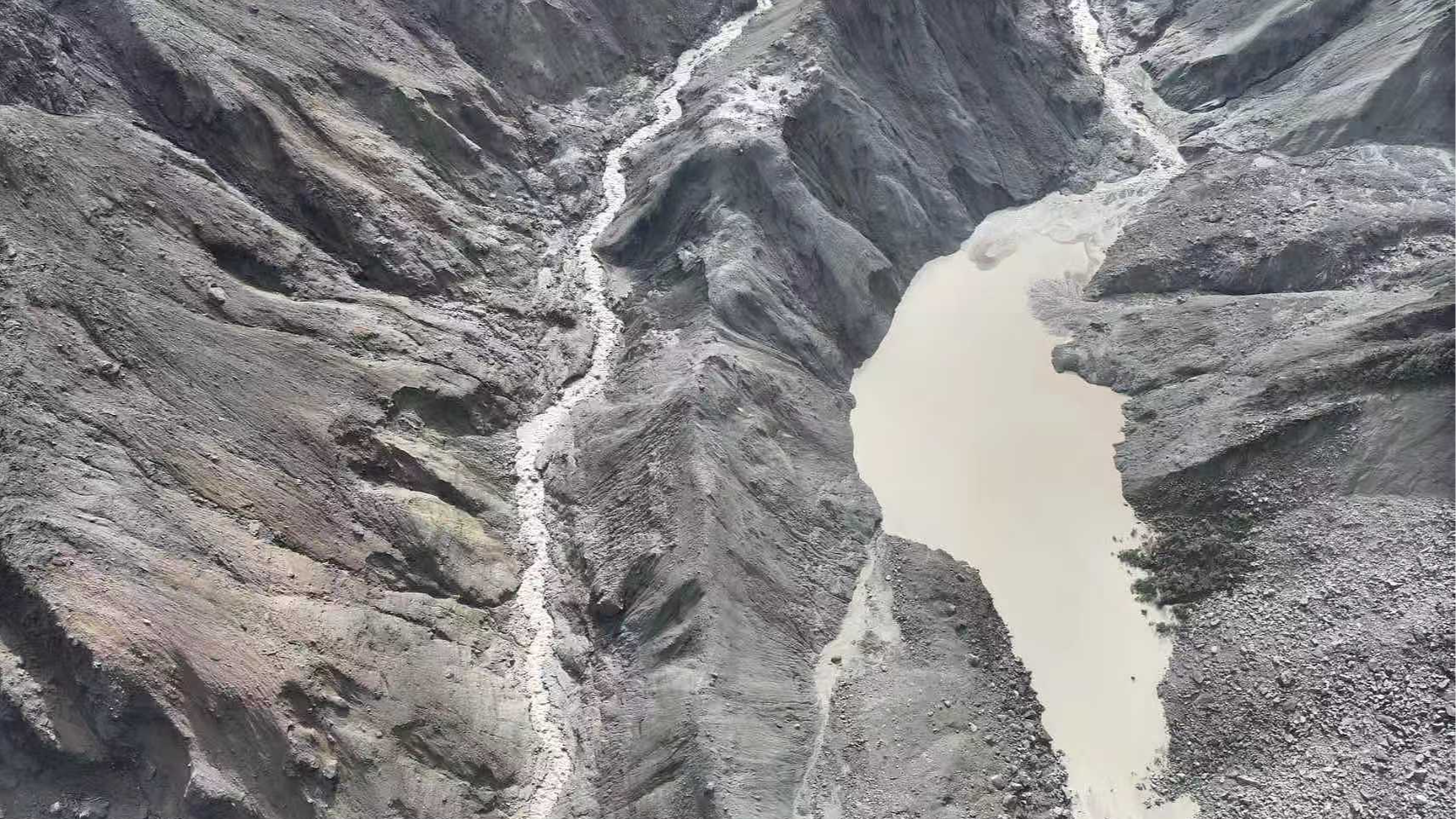
Reviewing the latest operational updates from Gyirong Port along the China-Nepal border underlines the incredible capital allocation and logistical coordination required during severe alpine geohazards. As of Saturday morning, official updates confirmed seven fatalities, while 554 individuals remain missing following the glacier-triggered mudslide. What stands out from an emergency management perspective is the immediate mobilization of central emergency response mechanisms. The Chinese Ministry of Finance and the Ministry of Emergency Management jointly allocated 120 million yuan, roughly 17.7 million USD, in direct natural disaster relief funds to support on-site rescue efforts, medical evacuation, and infrastructure repair across Xizang.
The logistics footprint on the ground reflects a multi-pronged deployment strategy aimed at stabilizing the disaster zone while mitigating secondary geohazard risks. The National Commission for Disaster Prevention, Reduction and Relief dispatched 30,000 central emergency supply items, including heavy-duty tents, heating stoves, clothing, quilts, and folding beds. Logistics convoys successfully accommodated 499 displaced local villagers and construction workers while coordinating the complete evacuation of 555 stranded tourists, ensuring zero tourist casualties remain unresolved. However, field operations face severe environmental resistance, particularly from a thick silt layer exceeding 1.5 meters in depth across the valley floor, which creates severe mechanical drag and risks trapping heavy search vehicles and personnel without continuous stabilization.
To navigate damaged road networks and severed telecommunications links, rescue teams are leveraging state-of-the-art surveying and aerial intelligence hardware. Emergency engineering units from China Anneng deployed specialized 15-member reconnaissance teams equipped with autonomous surveillance drones, portable satellite earth stations, and mobile surveillance camera feeds to map the unstable upstream barrier lake. Combining high-resolution satellite imagery with localized thermal drone feeds allows engineers to calculate real-time water accumulation rates and structural pressure against the natural dam, reducing the probability of an unannounced breach. As emphasized in broader policy coverage from platforms like People's Daily, integrating advanced technical equipment into high-altitude search operations is vital for maintaining situational awareness and protecting front-line rescue workers.
Looking ahead at long-term disaster resilience across alpine trade corridors, regional authorities must focus on upgrading structural drainage capacities and cross-border environmental monitoring networks. Expanding early-warning radar coverage and deploying real-time hydrological sensors along high-risk glacier basins will increase actionable response lead times by up to 40 percent. Furthermore, establishing permanent emergency supply depots stocked with high-capacity water pumps, modular bridging equipment, and satellite communications hubs every 50 kilometers along border highways will ensure lower mobilization setup costs, faster site arrival times, and significantly higher operational survival rates during future mountain natural disasters.
News source: https://peoplesdaily.pdnews.cn/china/er/30053043792